Difference between revisions of "UO:Atlas/Historical Maps"
BrianFreud (talk | contribs) m |
BrianFreud (talk | contribs) m |
||
| Line 2: | Line 2: | ||
<gallery mode=nolines widths=250px> | <gallery mode=nolines widths=250px> | ||
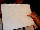
| − | File:6819311_40cd3d3801_o.jpg|The original plan for the UO map<br>circa summer 1998<br>(courtesy of [https://www.flickr.com/photos/doctorow/6819311 Cory Doctorow]<br>licensing: [https://creativecommons.org/licenses/by-sa/2.0/ CC BY-SA 2.0]) | + | File:6819311_40cd3d3801_o.jpg|The original plan for the UO map<br>circa summer 1998<br>(courtesy of [https://www.flickr.com/photos/doctorow/6819311 Cory Doctorow]<br>image licensing: [https://creativecommons.org/licenses/by-sa/2.0/ CC BY-SA 2.0]) |
| − | File:T2A_IMG_1130.jpg|The original Lost Lands plan<br>circa early 1997<br>(courtesy of [http://www.raphkoster.com/2012/09/25/ultima-online-is-fifteen/ Raph Koster]) | + | File:T2A_IMG_1130.jpg|The original Lost Lands plan<br>circa early 1997<br>(courtesy of [http://www.raphkoster.com/2012/09/25/ultima-online-is-fifteen/ Raph Koster])<br>image licensing: (pending) |
</gallery> | </gallery> | ||
Revision as of 11:03, 18 September 2016
Historical Maps of UO
The original plan for the UO map
circa summer 1998
(courtesy of Cory Doctorow
image licensing: CC BY-SA 2.0)The original Lost Lands plan
circa early 1997
(courtesy of Raph Koster)
image licensing: (pending)

